top-news
Is the Taklamakan Desert Turning Into a Wet Desert? Experts Say Flood-Drought Coexistence Is the True Reality
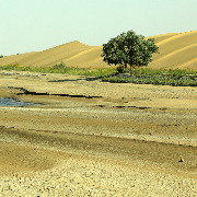
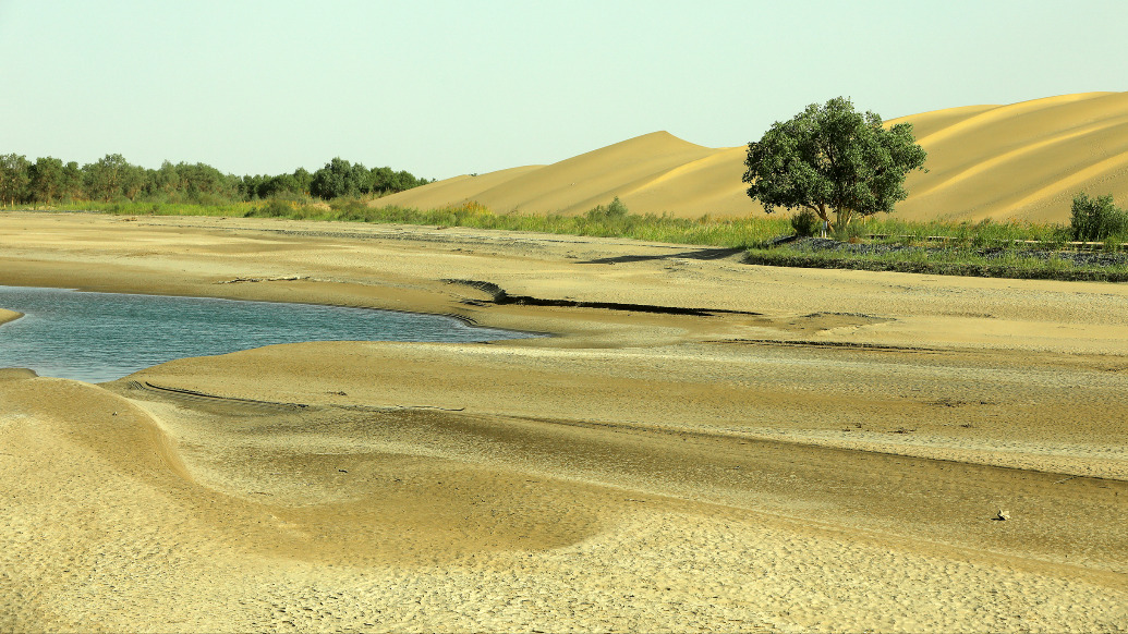
In recent days, the Hotan and Qiemo areas of Bayingolin at the southern edge of the Taklamakan Desert in Xinjiang have been hit by extreme torrential rain. The heavy precipitation triggered flash floods, with muddy floodwaters spilling over desert-edge roads and low-lying barren lands. Images of the desert flooding went viral online, with many netizens discussing whether the desert is becoming wetter and may soon grow large oases.
Is the "dry desert" really turning into a "wet desert"?
On June 26, 2026, Wang Hui, a senior engineer at the Xinjiang Climate Center, told media that the warming rate in Xinjiang is 0.33°C per decade, above the national average; the average annual temperatures in southern Xinjiang in 2022, 2024, and 2025 tied for the highest since 1961; average annual precipitation in Xinjiang and southern Xinjiang has increased by 7mm and 4mm per decade, respectively.
"Looking at the data, precipitation in Xinjiang is increasing, but it would be inaccurate to simply say the region is becoming 'wetter,'" Wang Hui said.
Data shows that from 1991 to 2020, the average annual precipitation in Xinjiang increased by 19.4% compared to the previous 30 years, with significant increases in the mountainous areas of western southern Xinjiang. However, the current average annual precipitation in southern Xinjiang is only 68.7mm, well below the national average (639.6mm) and the Xinjiang-wide average (177.9mm).
"Southern Xinjiang remains a typical arid region. An increase of 4mm per decade does not change its arid climate pattern," Wang Hui said, noting that over the past 30 years, the frequency of heavy rain events in southern Xinjiang has increased by about 27% compared to 1961-1990, and heavy snow events have increased by about 1.5 times. However, the number of precipitation days in Xinjiang has changed very little, meaning the increase in annual precipitation is mainly due to more extreme heavy rainfall events.
The Taklamakan Desert, located in the center of the Tarim Basin in Xinjiang, spans Bayingolin Mongol Autonomous Prefecture, Kashgar, Hotan, Aksu and other areas. It is China's largest and the world's tenth-largest desert, as well as the world's second-largest shifting desert, long characterized by extreme aridity and scarce rainfall. This rare flooding event has shattered the public's conventional perception of the desert.
Li Ruqi, chief forecaster of the Xinjiang Meteorological Observatory, explained that the sudden torrential rain in the arid desert zone was keyly triggered by special moisture transport and topographic conditions.
"Low-level easterly winds entered the southern Xinjiang basin from the east, traveling westward along the Kunlun Mountains; mid-level warm and moist air crossed in from the northwest corner of the Qinghai-Tibet Plateau. The two air currents converged in the mountain-front areas, with orographic lifting. Combined with surface warming that intensified the temperature difference between upper and lower altitudes, this greatly enhanced atmospheric convective dynamics. Under the combined conditions of circulation, moisture, thermal and dynamic factors, this extreme precipitation event formed," Li Ruqi said.
The Paper notes that in recent years, Xinjiang has experienced alternating extreme precipitation and extreme drought. In 2020, northern Xinjiang in spring and summer, and in 2022, northern and eastern Xinjiang from late spring to early autumn, both experienced the strongest drought events since 2000, while extreme rainstorms in southern Xinjiang repeatedly broke records.
Flooding in the Taklamakan Desert is not uncommon. Rivers such as the Tarim River and its headwater tributaries, including the Hotan River and the Yarkand River, frequently experience meltwater floods that overflow their channels into the desert.
In July 2021, the Yuqi area of Sinopec's Northwest Oilfield in the Taklamakan Desert was hit by floods, with inundation covering more than 300 square kilometers. In the summer of 2022, 21 rivers including the main stem of the Tarim River and its tributaries the Yarkand, Aksu, and Weigan Rivers experienced floods exceeding warning levels. The flood process on the main stem of the Tarim River lasted 80 days, ending only on September 22.
"The climate in Xinjiang is not simply becoming wetter. Rather, extreme weather events have increased, and the coexistence of floods and droughts is its true characteristic," Wang Hui said.